

Where we stayed: Bungonia NP campground, $17/night
What we did:
- Red Track a.k.a. Slot Canyon
- Bike Ride
If you’ve ever driven from Sydney towards Canberra or Melbourne then you’ll have passed signs on the highway for Bungonia National Park. If you’re like me then you might have also totally failed to clock them.
Bungonia National Park is only ~2hrs drive from Sydney and 1.5 from Canberra, and whilst it gets a lot less hype than some of the National Parks ringfencing Sydney (Blue Mountains, Royal National Park) it is definitely deserving of some.

Driving along the entrance road (2WD accessible, sealed road right up to campground) to the National Park you’re greeted by undulating farmland. If you’re driving in at sunrise in winter like I was you’re also likely to be greeted by a rising frost and some kangaroos.

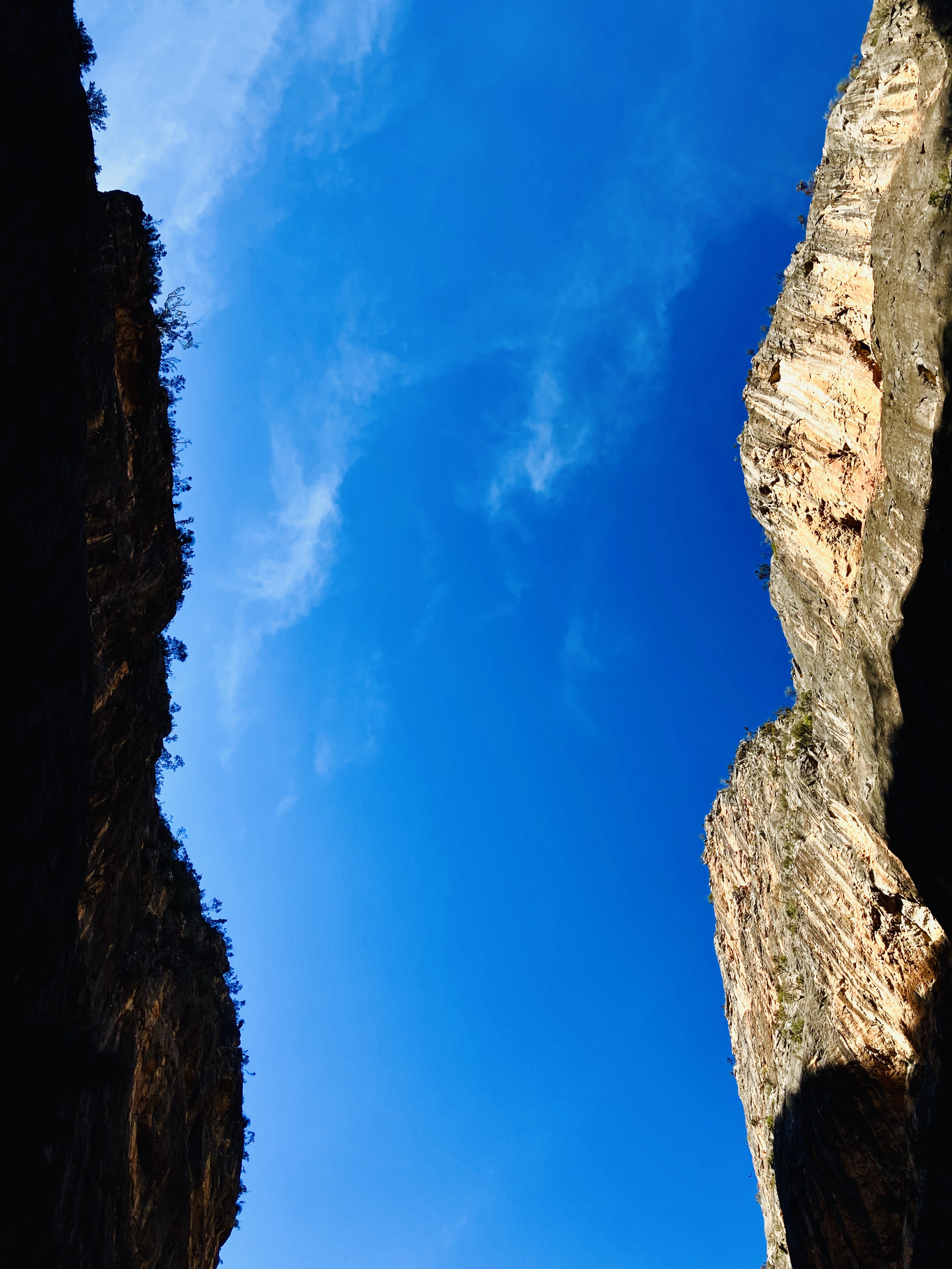
The fields turn to bush as you get to the National Park entrance, but the beauty and spectacular nature of the park isn’t apparent until you get up to one of the lookouts, at which point you realise you are teetering on the edge of a deep canyon, dropping steeply away from the ridge where the campground is situated.

There are 5 main walking tracks through the park. All starting near the camping area and with very easy to remember colour coded names.
We opted for the Red Track, also known as the Slot Canyon walk, and definitely carrying the most warnings on the noticeboard: “strenuous, falling rocks, not suitable for respiratory or heart problems, creek may rise suddenly, involves climbing over and around very large boulders, listen for sirens from the quarry above, 5hr loop”

Right… off we go!!
You know how often the signs in national park are somewhat feel-good? E.g. says it will take 1hr, actually takes 15 minutes? I’d say that the warnings for the Slot Canyon walk were pretty spot on, it was definitely challenging, but this also made it great fun and super engaging.

The sign suggested the walk was 3.8km and a 5hr loop. Not sure if it was elevation impacted but my Garmin route logged nearly 8km and 4hrs elapsed time.
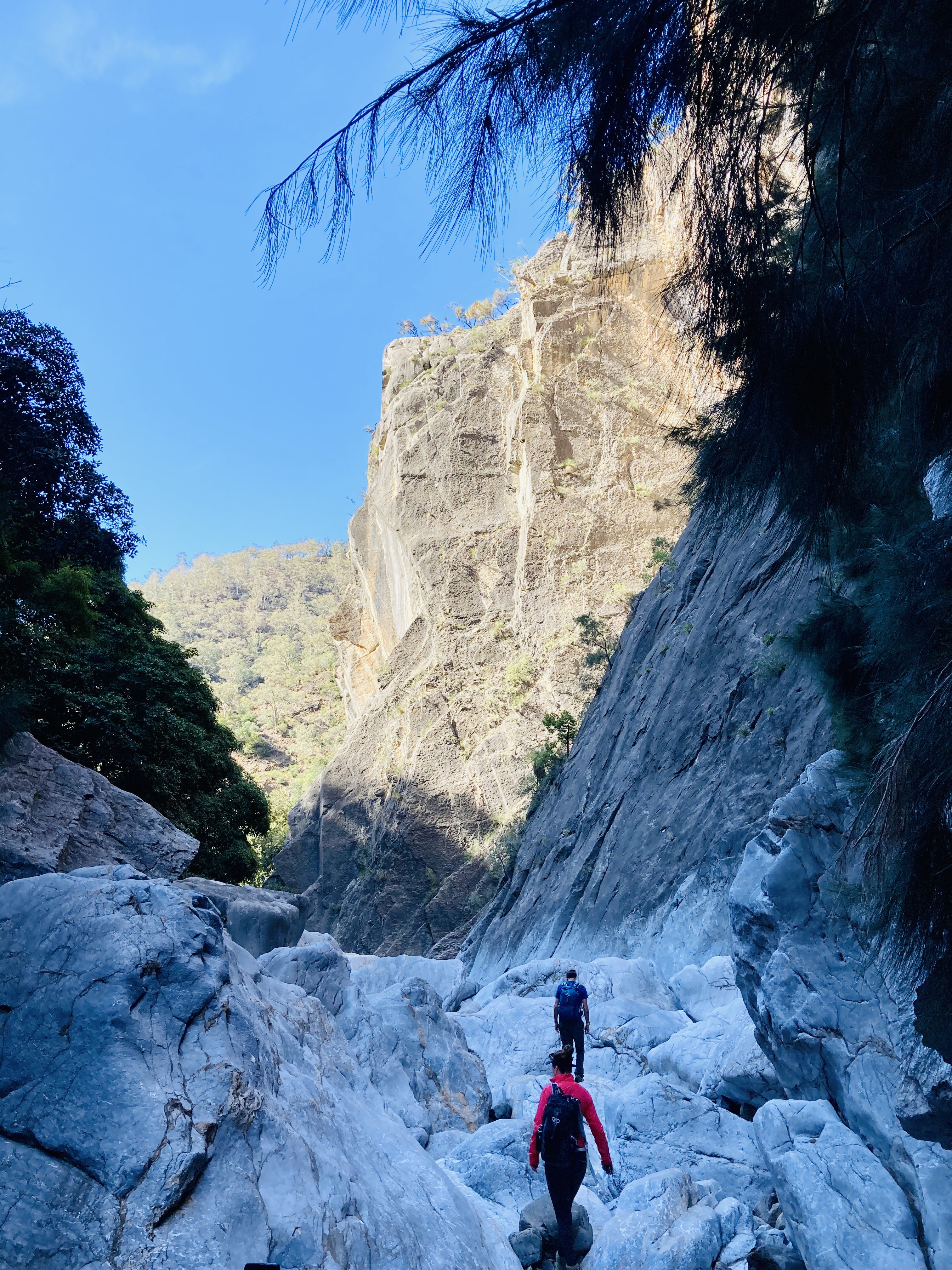
There is a suggested direction for the Red Track walk, and I’m very glad we followed the suggestion. It begins with a very steep descent, taking you down 300m vertically from the canyon lip at around 550m elevation, to the floor which is ~250m. You then pick your way along the canyon floor, and have a slightly more gentle ascent.
As soon as you leave the bush at the top of the canyon and begin the descent the nature changes.

The plants which flourish on the steep slopes were more spread out, and I assume requiring less water since much of it would head straight down into the valley.

There was a fun mini-rope descent on the way down, and quickly we were in the shade on the canyon floor.

The first section along the canyon floor was easy going, across small pebbles like a riverbed – it was easy to imagine it filled with water after a heavy downpour.

It was spectacular walking through the quiet canyon base, only about 50-100 metres wide, with the cliffs towering up either side.
The National Park is famed for its climbing, bouldering and caving. None of which we partook in, although Arthur was definitely tempted to have a climb! The caves are only accessible at certain times of year (mainly winter) due to a combination of CO2 levels, and mating bats requiring privacy.


Then we hit the fun part of the walk…the boulders! When the sign said climbing over and around large boulders they were not lying…
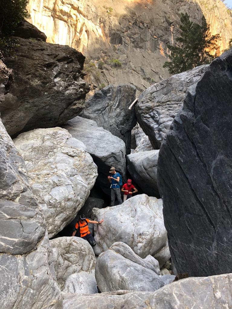
I was glad to be in a group of 5 of us. It meant that we could try multiple approaches to getting over and around the boulders, without ever feeling like you were at risk of getting stuck on your own down a crevice.
We’d each ‘pick a path’ and there were constant shouts of… “nope, don’t come this way“, “ooo yes I think I have a way. Oh no, wait….” A few places required a hand to be given as you hopped down, or for someone to take your bag to help a tighter squeeze!

Despite the mention of tight squeezes…if you are claustrophobic do not worry, you would be totally fine! As someone who doesn’t like feel trapped, I never did, since you are out in the fresh air all the time, and in beautiful surrounds.
Once we’d picked our way through the boulder field we were greeted by a beautiful natural limestone bridge and small pool which marked the start of a creek.

We followed this along a while before finding a picturesque spot to stop for our picnic. Very well earned at this stage!

The scenery was reminiscent of areas of North America – for me it felt a bit like Yosemite with the towering rock faces.
Refuelled, we were ready to tackle the climb back up. We took this slow, and it was lovely to get back into the warmth of the sun (although quickly became rather hot from the strenuous nature of the climb!)

The walk would be do-able in a day from either Sydney or Canberra, but I was glad to be camping meaning we could hop into the hot showers, get wrapped up warm, and have a rewarding dinner before snuggling up for the night.

The layout of the campground was great, with lots of little offshoots meaning we had our area to ourselves, with a gas BBQ provided. There was still a total fire ban, which made winter camping somewhat fresh, but I took my hot water bottle along, keeping me toasty into the night.
Along with hot showers, the campsite had a heated camp kitchen, filtered drinking water refill points and multiple BBQs.
Currently you need to book in advance to camp, and purchase a national parks entry pass online.
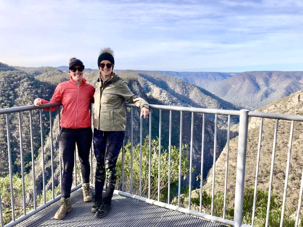
We rounded out the weekend with a bike ride around the country roads the next morning, even found somewhere for a coffee stop! 🙂

Well worth a visit!
Xx

Another interesting trip + great pix. It looks and sounds a beautiful area. MJW xo
LikeLike